Editor’s note: This article will be updated regularly with the latest forecast and information on school district and community college closures.
As efforts continue to clear roads from ice following last weekend’s winter storm, Gov. Josh Stein declared a new state of emergency on Jan. 29 ahead of another winter storm this weekend.
“As another round of winter weather moves into North Carolina, this time possibly bringing snow, I urge everyone to stay alert and take precautions,” said Stein in a press release. “Our emergency management teams and NCDOT crews continue to work around the clock, and I’m grateful for their continued dedication to keeping North Carolinians safe. Please continue to use caution when driving and follow the same safety steps that helped keep people safe last weekend.”
Latest forecast | Friday, Jan. 30 at 9 a.m. ET
by Tom Sorrells
Over the next 48 hours, another winter storm is going to blast North Carolina with snow. The National Weather Service (NWS) has issued a Winter Storm Warning for all of our state.
For those of you who have lived here a long time, this setup is more like the December snow storm of Christmas week back in 1989 than the nasty part ice/part snow system we had last weekend.
What will that mean for you? Let’s start by looking at the storm.
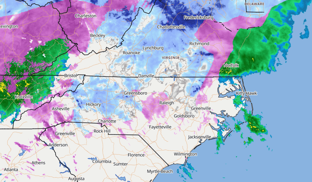
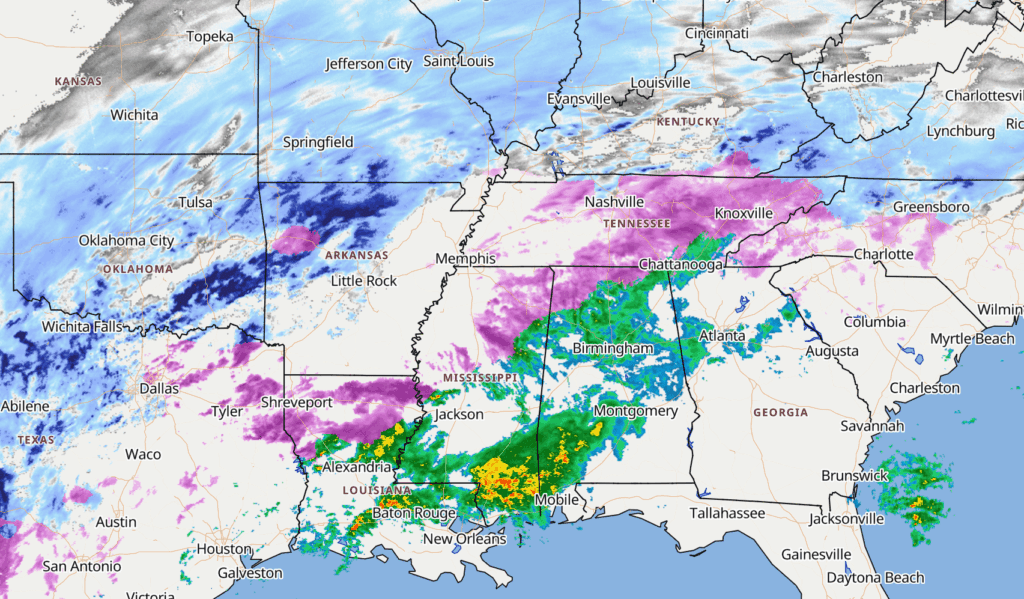
Here is the weather map for tonight at 7 p.m.
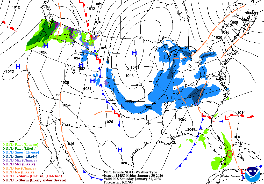
The low is developing off the coast. In the afternoon and early evening tonight, some of the snow showers will develop over the western mountains and zones into the Piedmont. These will be nice and fluffy, light, and patchy. But overnight conditions fall apart and the accumulations begin to pile up.
This low is expected to become a “bomb cyclone.” That is the term used for a low pressure center that drops at least 24 millibars in pressure in 24 hours. Think of it as a rapidly strengthening hurricane. The situation gets serious overnight.
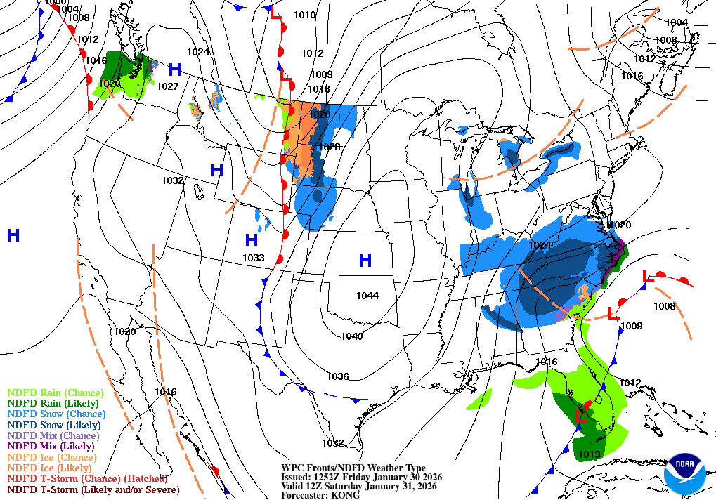
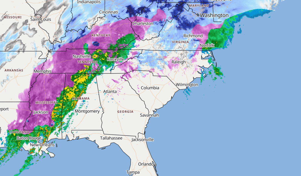
Here is the map by 7 a.m. Saturday morning.
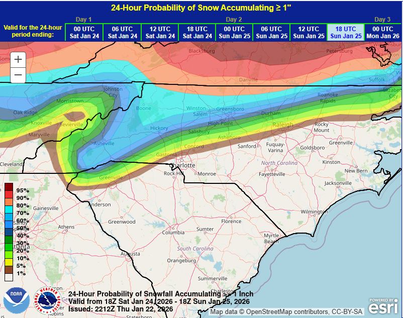
The snowfall total forecast is huge! Look at this forecast for our western zones from Asheville with 4 to 6 inches, over to Hickory and Charlotte with 6 to 8 inches.
The NWS issued this graphic earlier today:
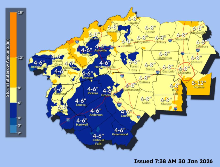
The expected snow totals from Lumberton to the Outer Banks are even heavier.
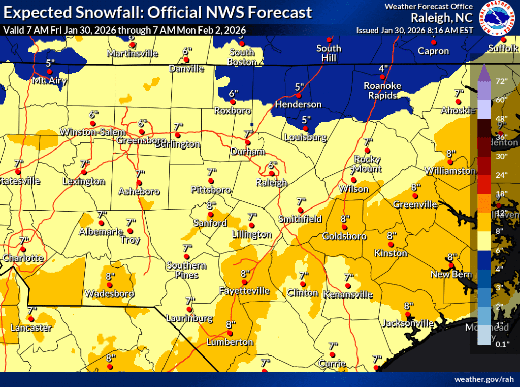
The time frame for the arrival of the snowstorm is tonight into Saturday in the west, Saturday mid-day and overnight Saturday into Sunday for the central part of the state, and Saturday afternoon into Sunday morning for the coast.
A few notes here: This will be a big snow maker. Our totals are based on the models and our experience of what happens when the atmosphere looks like this. It is going to snow. However, some of the totals may be a tad large because the air is so cold and dry. That might keep the totals under the high marks, but not by too much.
This system becoming a “bomb cyclone” will almost certainly mean lots of high wind — most especially along the coast where some wind gusts will approach the 60 mph mark. And even across inland areas, look for winds to max out Saturday around 30 to 35 mph. That will make for horrible wind chills and drifts of snow up to a foot or more.
In addition this “bomb cyclone” will be a coastal flooding event for the outer banks with 2 to 4 feet of sea water covering low-lying areas — enough to cover the shoreline, roads, and parts of Highway 12.
School district and community college closures
School district and community college closures are now being updated in the article below.
Previous forecasts
On Jan. 21, Gov. Josh Stein declared a state of emergency ahead of a winter storm anticipated to cause “significant impacts.”
During a winter weather briefing on Jan. 22, the governor urged North Carolinians to stay informed, gather necessary supplies, prepare for the potential loss of power, and avoid driving starting Saturday.
“This weekend’s winter storm is likely to impact most of North Carolina, so please make a plan now to keep yourself and your loved ones safe,” said Stein in a press release. “The most important thing you can do right now is prepare for potential power outages and have emergency supplies ready.”
Sunday, Jan. 25 at 10 a.m. ET
by Tom Sorrells
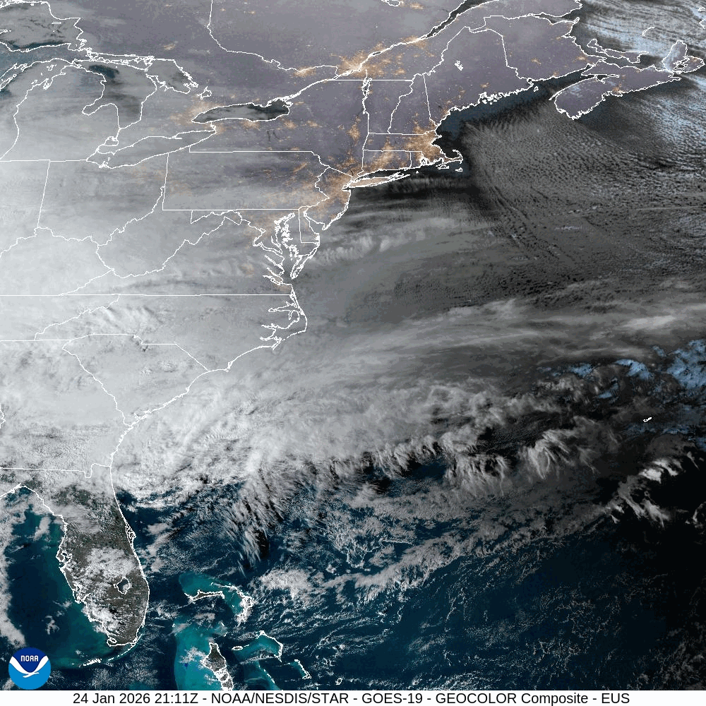
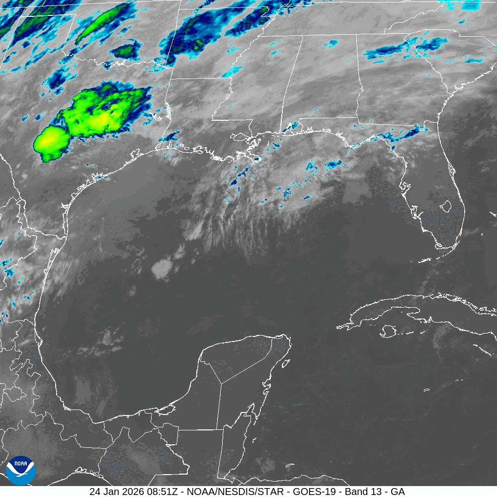
As of 10 a.m. Sunday morning, the storm is still marching over us, with more to come.
This is radar of North Carolina, and you can see the patches of freezing rain over Asheville, Raleigh, Cary, Pittsboro — it’s a dangerous mess already.
Please know this is NOT the end of the system. As we look to the west, the bulk of the moisture is marching our way.
This line of snow, sleet, and rain will move over us this afternoon and evening. With Arctic cold air damming against the eastside of the Smokies, all of the “rain” will fall into our freezing temps and cover us with a lot of freezing rain.
The current temperature at 10 a.m. in Raleigh is 22. Our forecast high is 28. In Asheville, the temperature is currently 32 — in Charlotte, it is 18.
I believe the Asheville area will get a little less than 1/2 an inch of accumulation of the wintry mix before switching over to rain to end the system late tonight. The low in Asheville will drop to 17 degrees, meaning a hard freeze for everyone. Then, on Monday, the high is only 26 — not melting until Tuesday afternoon.
In Charlotte, look for more heavy ice/sleet and freezing rain to fall between about 2 or 3 p.m. until about 7 p.m.
The same is true for the Triad and Triangle — a line of heavy precipitation of sleet and freezing rain will march through in the afternoon. If you still have power, continue to make sure you keep things charged up. This line of icy precipitation will be accompanied with strong winds. The combination of wind and heavy freezing rain/wintry mix is still expected to bring power outages.
One last side note: Have you ever seen a video of meteorologists, reporting live in the storms, jumping up and down when they hear thunder as it is snowing? This afternoon, as the line of heavy precipitation moves over central and eastern North Carolina, it may very well produce some lightning and rumbles of thunder. You may actually experience “thundersnow.” Or, in this case, “thunder ice, or thunder freezing rain!”
Saturday, Jan. 24 at 9:00 p.m. ET
by Tom Sorrells
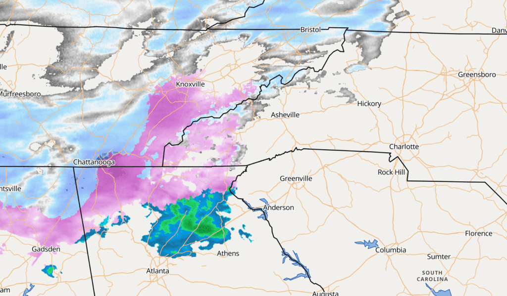
Radar at 8:30 p.m. shows the line of ice and freezing rain along the I-85 corridor has verified pretty well with the model projections. The areas from Greensboro to the north are mostly snow. The pink is all the freezing rain and sleet.
The temperature at 8 p.m. is 24 degrees in Asheville, 18 degrees in Greensboro, and 21 degrees at RDU International.
Overnight, I expect more ice and sleet accumulations in the western areas from the southwest state line through Asheville to Hickory. During the day on Sunday this zone will have more freezing rain early and then change back over to rain Sunday afternoon.
This change back to rain will help to wash some of the ice and sleet away, but not until after the damage is done.
There is plenty of moisture back to our west heading our way overnight.
From the Triad to the Triangle, I still think the wintry mix of snow, sleet, and freezing rain will add up to about half an inch before sunrise Sunday morning and then pile on more sleet during the day Sunday. The temp high on Sunday will be right at 32 degrees.
The really cold air arrives Monday as winds begin to blow from the northwest 5-15 miles per hour (mph), gusting up to 25 mph. Even though most of the coming five days will be dry, the bitter cold will be staying around. The overnight low Monday night into Tuesday will be 11 degrees!
Saturday, Jan. 24 at 8 a.m. ET
by Tom Sorrells
At 8 a.m., the leading edge of the precipitation is starting to arrive in our far western side of North Carolina.
Some of the freezing rain/ice/sleet may be mixed in with some snow. But this is the beginning of the ice storm. The National Weather Service (NWS) has issued an Ice Storm Warning for the far western part of the state, from 1 p.m. today until 1 p.m. on Monday. The forecast from yesterday still holds. Expect damaging icing with totals of sleet and freezing rain to reach more than half to ¾ (.75) of an inch.
Across the Piedmont and Triangle, the NWS has a Winter Storm Warning, shown in pink on the map below, with heavy mixed precipitation producing ice accumulations of half an inch or greater and a couple of inches of snow. That Warning goes into effect at 7 p.m. this evening and goes until 1 p.m. Monday.
For the areas from Goldsboro, Kinston, and points to the east, a Winter Weather Advisory is in effect. These areas will have the same type of freezing rain, sleet, and cold — only just a little less of it. The travel will still be hazardous, the wind will still be wicked, and widespread power outages will still happen.
Bottom line here is: Nothing has changed. You have a few more hours to get ready. You need to have battery operated devices charged, medicines filled, food supplies for four days, and some way to keep warm. The Arctic cold will be with us for most of next week. The National Weather Services keeps using the term “crippling and catastrophic damage.” I beg you to take them seriously.
Friday, Jan. 23 at 11 a.m. ET
by Tom Sorrells
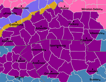
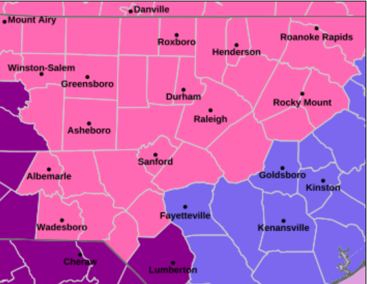
Western North Carolina is now under a NWS Ice Storm Warning from Saturday at 1 p.m. until Monday at 1 p.m, shown in dark purple on the above map. This includes Asheville and Hickory, and stops just shy of Boone and Winston-Salem.
The forecast is still on track for up to 2 inches of ice to accumulate. Cold, wind, and wind chills will be factors even after the precipitation ends. Winds will gust to 30 mph and will take down ice-covered trees and power lines.
Winston-Salem, Greensboro, and Asheboro are all under a Winter Storm Warning, shown in pink on the map above, from Saturday at 1 p.m. until Monday at 1 p.m. This area should still be on guard for ice and freezing rain, but can expect more snow mixed in with the ice.
For now, the Triangle down to Lumberton and east to Kinston are under a Winter Storm Watch. I fully expect that Watch to be upgraded to a Warning in the next few hours.
Friday, Jan. 23 at 6 a.m. ET
by Tom Sorrells
For now, the National Weather Service has not upgraded the Winter Storm Watch to a Winter Storm Warning, but I do expect that to change as the day goes on. Warnings are typically issued about 24 hours before hazardous weather begins.
Forecast models continue to show a dangerous setup, with freezing rain, sleet, and significant ice as the primary threats. At this point, impacts are still expected to begin around midday Saturday in western North Carolina, then spread east across the state through the afternoon.
Residents should use today (Friday) and early Saturday to complete preparations. Be ready to shelter in place. Make sure cellphones, radios, and other battery-powered devices are fully charged. Prepare for the possibility of extended power outages that could last several days.
Downed power lines and falling trees are likely. Avoid parking vehicles under trees. Plan for several days of food supplies and be sure you have any medications you may need through at least Wednesday.
We’ll have another update by noon today.
Thursday, Jan. 22 at 9 p.m. ET
by Tom Sorrells
Let me begin by saying, even at this late hour, this forecast is still VERY fluid. Almost like a hurricane tracking just off the coast, little wobbles or movements and changes aloft will mean big differences for what is happening at surface level where you live.
Let’s dive in.
This storm will be one for the ages for a large part of the southern half of the United States. North Carolina will be getting impacts. Those impacts really get going on Saturday afternoon.
For now, Friday looks like a day to get ready. Temperatures on Friday will be in the upper 40s across most of the state. You may have a passing light shower, but that is not the beginning of the trouble. The trouble begins as the true cold air filters in overnight Friday into Saturday.
By sunrise on Saturday, the temperature in Raleigh will be 22 degrees. We will be dry, but cold. By the afternoon, all of that changes.
The first part of our state to get mixed precipitation will be the far western areas. The earliest flakes and wintry mix will arrive in Asheville by mid-day Saturday. My forecast calls for the temperature to be 32 degrees at 1 p.m. in Asheville — it may very well begin as freezing rain at that hour. If it does fall more as freezing rain, it will probably exceed half an inch of ice. If it is more sleet, look for a higher ice total nearing the 2 inch mark.
Mixed precipitation should arrive in the Triad and then the Triangle between 3 p.m. and 5 p.m. Saturday. The first “flakes” may not be flakes at all, but sleet or freezing rain.
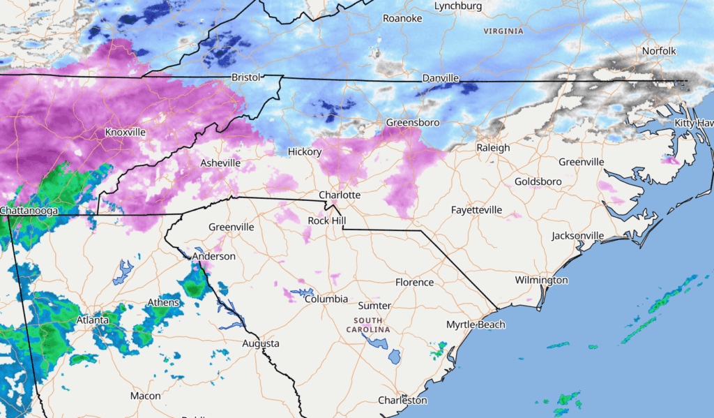
This is the Euro model of what radar should look like by 7 p.m. on Saturday night.
This is the beginning.
The models do not let up until late Sunday night into early Monday morning. The problem is this is looking to be mostly a freezing rain event from the mountains in the west all the way across the state to Raleigh and farther east.
So, how much ice are we talking? As of 9 p.m. on Thursday, it appears to be a solid forecast to call for anywhere from a quarter of an inch to half of an inch of ice across an area along and north of the I-85 corridor. This will not be a good outcome for those of you in that area. If more of the precipitation falls as sleet, this could be a low estimate. In that case, we could end up with a large part of the I-85 corridor with ice totals in excess of an inch and a half!
Either way, travel is not going to be safe once the wintry mix begins. Even early on in the event, freezing rain will coat roads with black ice and it will not be safe.
Farther to the south along the state line from Charlotte into South Carolina, you could end up with only a brief period of freezing precipitation, while to the north it really gets ugly.
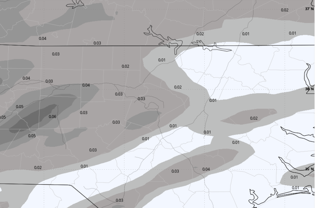
This is the latest view of probability of accumulation.
For those farther north along the Virginia state line, this looks more like a snow event. Heavy snow to be sure, but not the ice event for those farther south.
This is a good time for me to remind you that the internet is full of click-bait meteorologists and graphics. Please consult your local National Weather Service (NWS) office, linked below, for official, trustworthy information.
Now is the time to get ready. You do still have time to prepare. Ask yourself, “Do I have enough food to last me for 4 to 5 days? Do I have a way to stay warm in power outages? Is my car parked in a spot where falling trees or powerlines can’t hit it?”
And one last forecast reminder. The rebound from this system will take time. Early next week is not much warmer. We do not have a prolonged thaw in the forecast. Today is the day to get ready.
Let me say again — a little movement north or south with the track of this system will make for huge differences across North Carolina.
I will keep you posted with updates through the weekend.
Resources
- Winter weather safety and preparation information: Visit ReadyNC.gov
- Travel information: Visit DriveNC.gov
- Weather updates: Follow the National Weather Service (NWS) office near you for local forecast information.


Recommended reading