This story is no longer being updated.
Monday, Sept. 29 at 1:00 p.m.
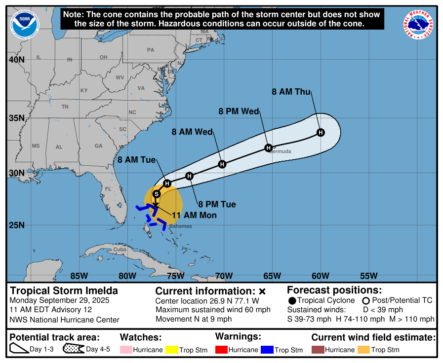
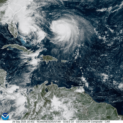
The improving forecast trend that began over the weekend held strong into Monday, bringing good news for North Carolina. Tropical storm watches in Florida were lifted Sunday afternoon, as Tropical Storm Imelda is now expected to remain well offshore — east of Florida today and south and east of North Carolina by Tuesday.
The dramatic shift in Imelda’s path is mostly thanks to Hurricane Humberto, which intensified into a Category 4 storm in the Atlantic. Its powerful circulation is steering Imelda away from the U.S. coastline.
Unfortunately, this redirection places Bermuda directly in the path of a potentially significant storm threat by late Wednesday or early Thursday, as Imelda strengthens and transitions into a potent extratropical system.
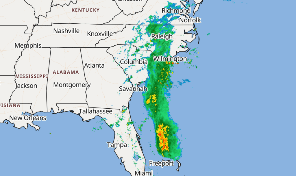
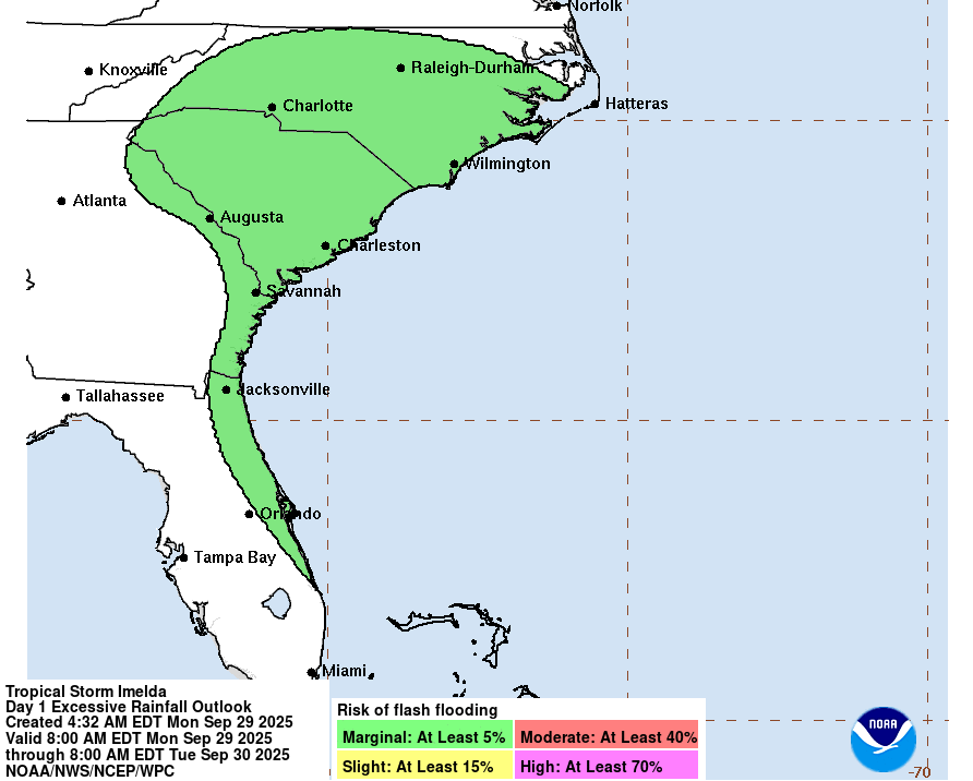
A surge of tropical moisture ahead of Imelda has already reached the Carolinas, fueling widespread showers along a stalled cold front. While this continues into Tuesday, the risk of widespread flooding across the Southeast continues to decline, thanks to Imelda’s sharper turn out to sea.
The biggest concern for the U.S. this week will be hazardous surf and marine conditions from both Humberto and Imelda, stretching from Florida to North Carolina. Most of the heavy rainfall will stay confined to the open Atlantic.
Sunday, Sept. 28 at 10:00 a.m.
The tropical depression offshore has been steadily organizing overnight. Pressure has dropped to 1003 mb, and satellite imagery shows a tighter circulation forming with deeper convection. All signs point to this system getting named Tropical Storm Imelda very soon.
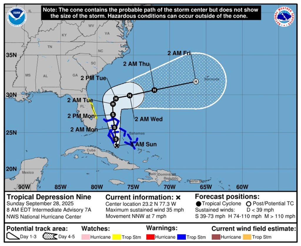
Over the last 48 hours, forecast models have become more confident in the storm’s track — and here’s the good news: It’s looking less likely that the eye will make landfall in North Carolina. That’s a relief, especially since we’ve always expected the biggest threat to be heavy rain and flooding.
Now, while our overall risk is slightly lower thanks to the shift in the track, the storm is also expected to slow down significantly as it makes its turn. That could mean prolonged rainfall for parts of central and eastern North Carolina.
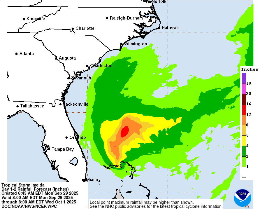
Between now and Wednesday evening, the Euro model is showing a bullseye of nearly three inches near Myrtle Beach, with other heavy pockets around Lumberton and Wilmington. How much rain we actually get will depend on how slow the storm turns — and when.
As of now, I’m still expecting this to be a late Monday arrival, with rain continuing through Tuesday and possibly into early Wednesday.
Check back first thing tomorrow for the latest updates.
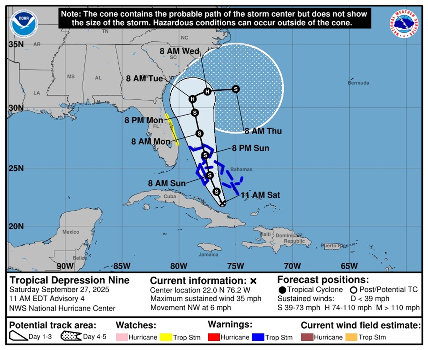
Saturday, Sept. 27 at 11 a.m.
The system that is expected to become Tropical Storm Imelda has developed deep convection over the past 24 hours. As it continues to intensify through Monday, tropical storm conditions are likely across parts of the central and northwestern Bahamas through Sunday night, with similar conditions possibly reaching the east coast of central Florida by Monday.
The greatest concern with this system remains heavy rainfall. Widespread downpours are already affecting eastern Cuba, Hispaniola, Jamaica, and the Bahamas, and will continue through the weekend. Flash flooding and urban flooding are likely in these areas, with mudslides possible in mountainous terrain. This same threat could shift north, bringing the potential for flash, urban, and river flooding to our region from late Monday into Tuesday.
There is also a chance the storm could strengthen into a hurricane, which would increase the risk of damaging winds, higher storm surge, and heavier rain.
Here is the bottom line: While the latest forecast trends offer some encouraging signs for central North Carolina, it is still too early to let our guard down. Some models continue to show possible storm tracks moving through the Carolinas on Monday into Tuesday. The most likely timing for local impacts appears to be Monday evening through Tuesday, with lingering effects possible into midweek.
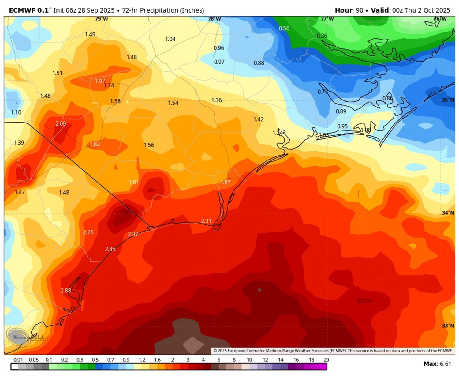
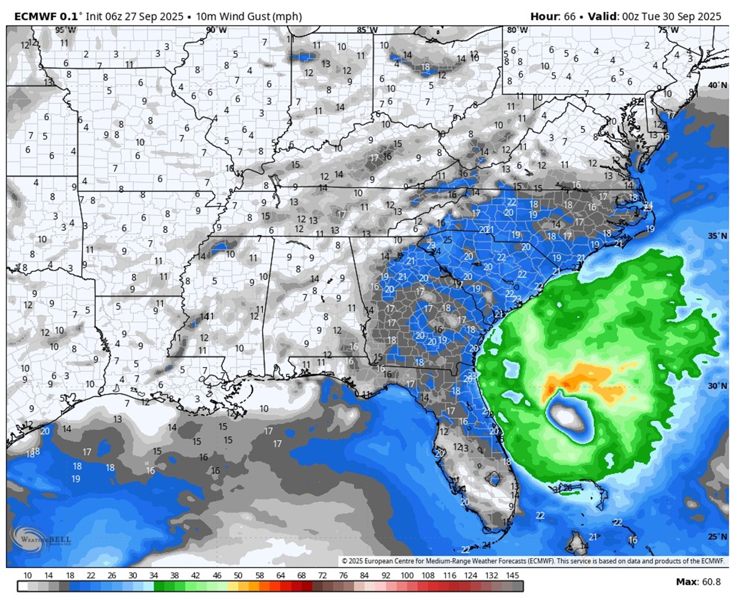
This is the Euro model for rain totals and location of the system on Monday, Sept. 29 at 7 p.m.
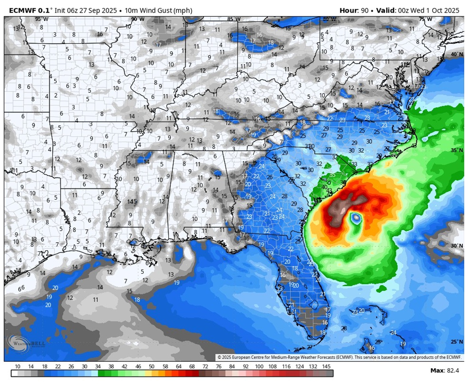
Here is the Euro model for the system Tuesday evening at 7 p.m.
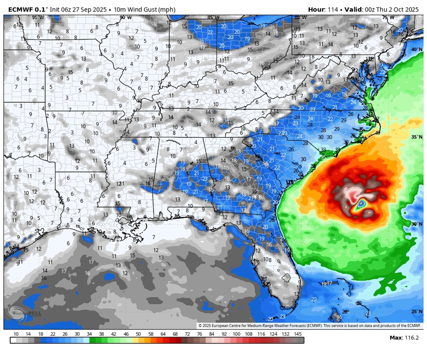
Here is the Euro model for the system Wednesday evening at 7 p.m.
Here is the Euro model for the system Thursday evening at 7 p.m.
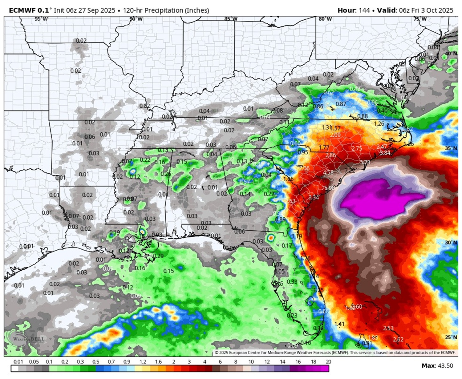
Rainfall totals for the week look substantial along the coast.
This is a fluid, changing, developing situation.
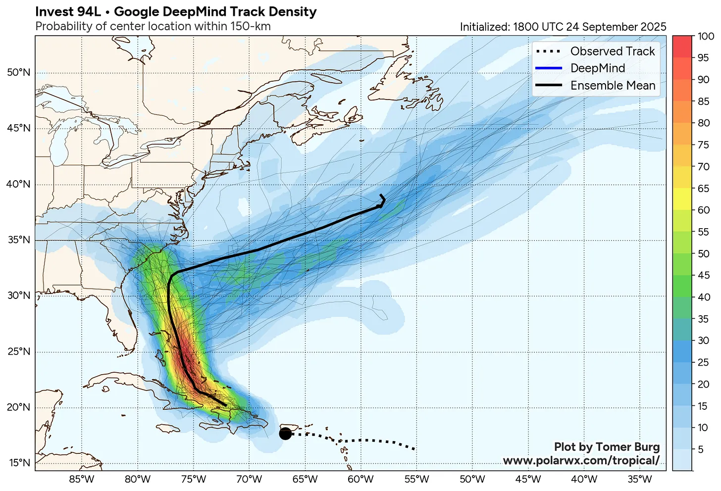
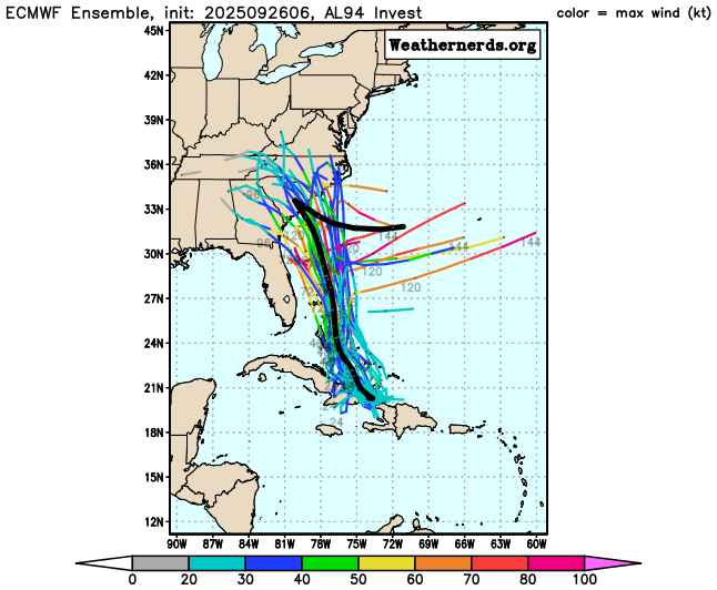
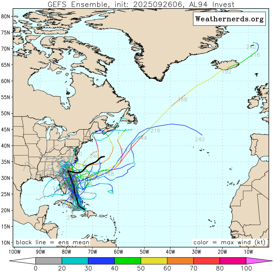
Friday, Sept. 26 at 11 a.m.
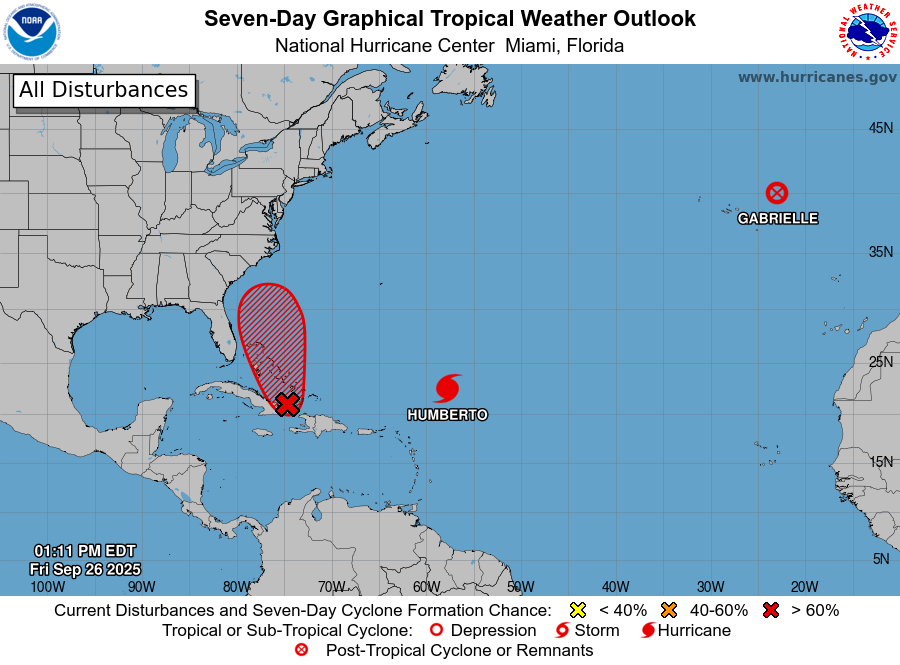
A developing tropical system, currently designated Invest 94L, is gaining strength just west of Hurricane Humberto and could become Tropical Storm Imelda this weekend as it moves into the Bahamas. Forecast models currently suggest that Invest 94L could approach the North Carolina coast by Monday or Tuesday.
The forecast is tricky due to the interaction between Humberto and Invest 94L. Recent trends show Humberto slowing down to the east while Invest 94L speeds up to the west. This increased distance between the two systems is helping reduce their influence on each other — and with it, the uncertainty in forecast models.
Models from Friday morning have shifted Invest 94L’s track slightly westward, increasing the chance of the Carolinas being impacted early next week. However, updates from early Thursday morning, and models from Friday morning below, nudged the system back offshore, meaning a direct strike on North Carolina is still uncertain.
Invest 94L is heading into an environment with warm waters and favorable upper-level winds, which could support rapid development as it nears the southeastern U.S. coast. While intensity forecasts remain inconsistent, the setup suggests a growing risk of tropical storm or hurricane conditions for coastal North Carolina.
To improve accuracy, Hurricane Hunter aircraft are actively flying into Invest 94L to gather data on its structure and surrounding atmosphere. This new information will be fed into forecast models today and should help clarify the storm’s path and strength.
While it’s too early to say just how much North Carolina will see direct impacts, the risk is increasing. Residents should stay informed and be prepared for potential tropical storm or hurricane conditions early next week. Forecasts for systems like 94L can change quickly, especially before they fully form.
Let’s look at the models.
This is the Euro model for rain totals and location of the system on Sunday, Sept. 28 at 7 p.m.
This is the Euro model for Monday, Sept. 29 at 7 p.m.
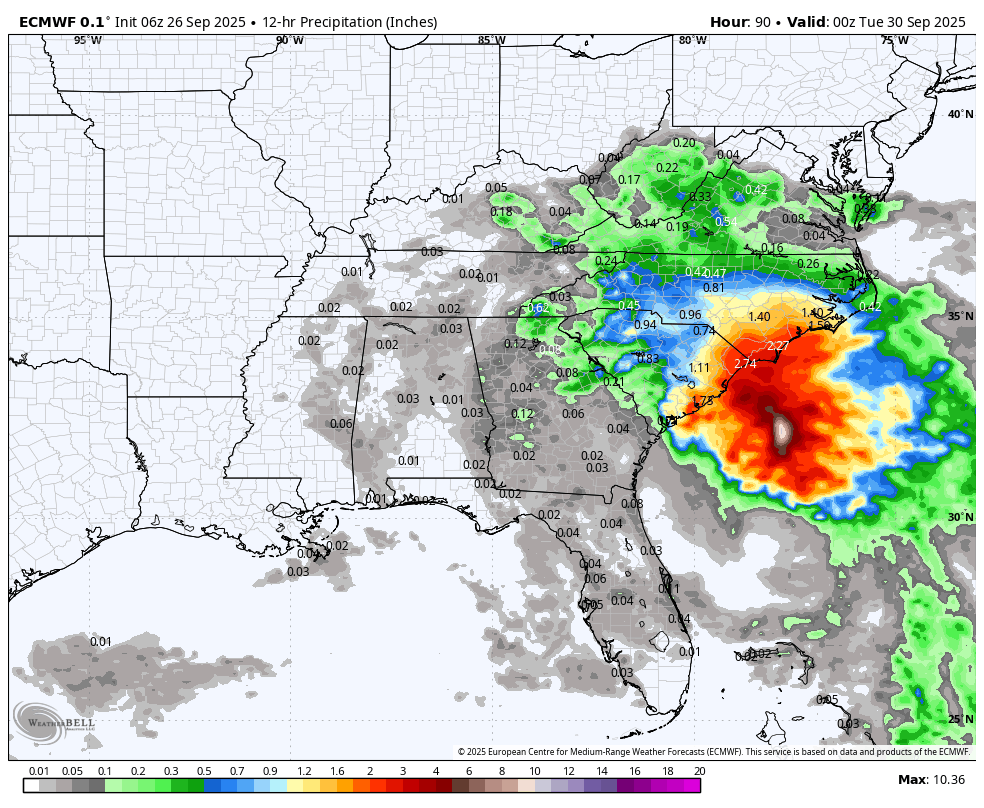
The rainfall total in the 12 hour period on Sunday between 7 a.m. and 7 p.m. is reflected above. Horry County, where Myrtle Beach is located, and the Wilmington area look very wet.
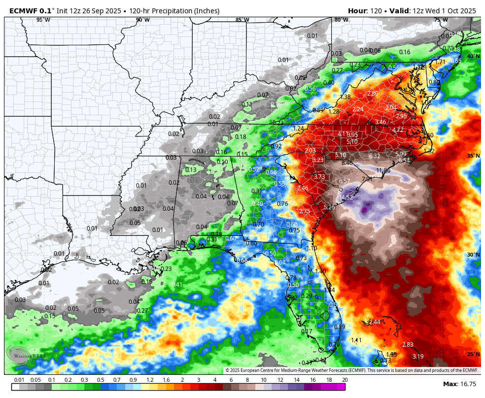
Below is the rain total from now until 7 a.m. on Wednesday. This is not 30 inches of rain in 36 hours like storms of the past, but it is concerning. There will be flooding, warnings, and survival issues. People need to pay attention over the weekend and NOT think just because the wind is not that bad that it’s going to be a walk in the park.
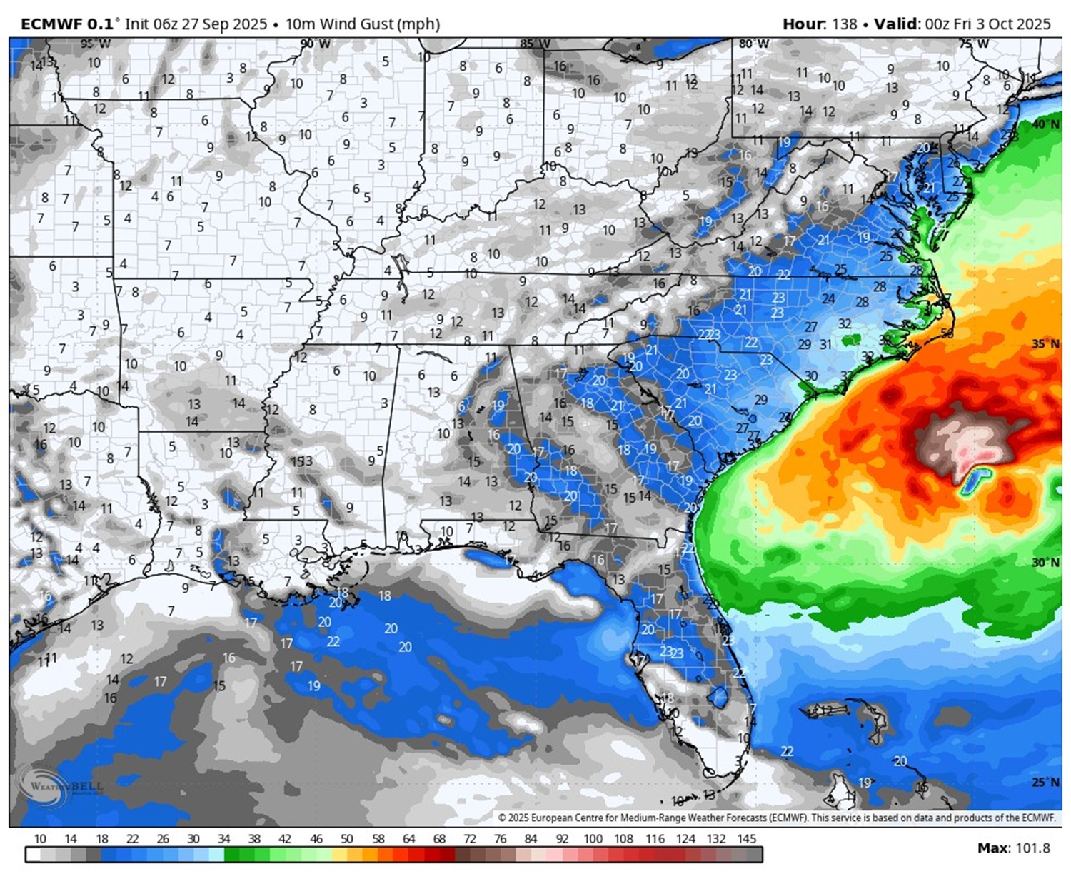
Let’s look at wind gusts on Tuesday.
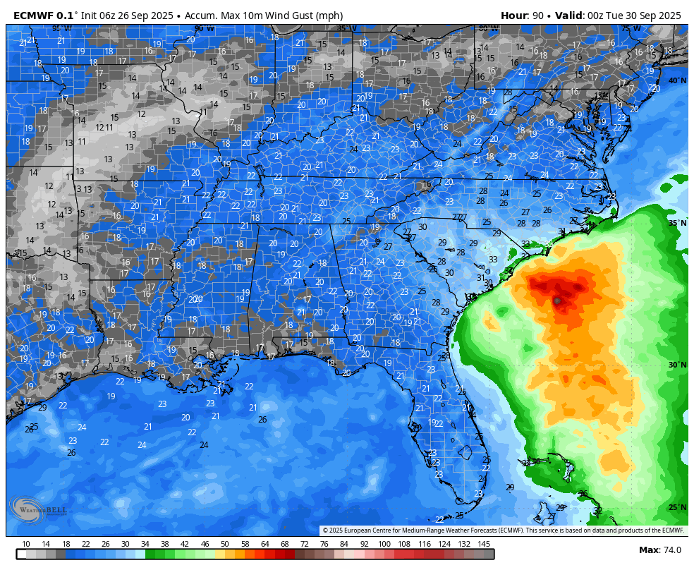
This system is not a super wind maker at this point, but Wilmington may get tropical storm-level gusts.

Recommended reading