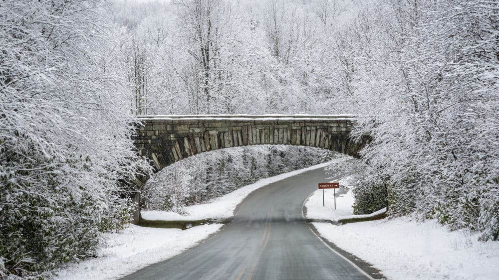


Winter Storm Diego has dropped just over 18 inches of snow in some parts of western North Carolina with impacts felt across the state. Numerous school districts are closed today, road conditions may continue to worsen into Tuesday, and hundreds of thousands were left without power.
I recently spoke with my dad, chief meteorologist at WKMG News 6, the CBS affiliate in Orlando, Florida, about Winter Storm Diego, snow cream, and everything in-between. If you have questions about weather that we didn’t answer, drop them in at the bottom of this page.
I’ve heard a lot of anecdotes about it not being common for North Carolina to have a winter storm like this in mid-December. What does the historical data say?
Early winter storms like this are fairly uncommon, but not unheard of. The bigger snow makers usually don’t show up until January, February, or March. However in 2009 and 2010 we had snows in December. And if you go back to the heaviest snow total of all time in Raleigh, that happened in January of 2000. That January 25 it snowed a total of 20.3 inches, and while that did happen 25 days into the New Year, the earth doesn’t really care about our calendar count of days.
It could just as easily have been that the set up for that heavy snow happened in December that year instead of waiting until January. Think of it in comparison to hurricane season. Most of our storms happen after August 1, but that does not mean North Carolina can’t get a storm in June. It does not happen with regularity, but it can happen. That is why the season runs from June 1 to the end of November.
Meteorologically speaking, we are in winter already. We all know that winter actually arrives on December 21, but that is the date based on the astronomical scale — when the sun crosses the Tropic of Capricorn, or reaches its most southern point in the sky. Meteorological winter is based on the months of December, January, February.
So back to the direct point: we don’t often get big snow storms in December in North Carolina, but it does happen, and folks shouldn’t be shocked when we do.
Speaking of historical data, click here to see your chances of having a white Christmas.
What’s the difference between hail, sleet, and freezing rain?
All of these are types of precipitation. Hail is frozen precipitation that comes from thunderstorms. It is not associated with winter snow storms. When I lived in the Midwest it was not uncommon for people to call me in the weather center and say, “You would not believe how heavy the hail is here in Monroe!” What they actually meant was “You would not believe how heavy the sleet is here in Monroe!”
Hail is a large, lumpy, stone looking piece of ice. Hail stones are formed when supercooled water drops in the clouds keep colliding with other droplets. These collisions lead to layer upon layer of ice to develop in a stone or ice rock fashion. These stones are lifted by thermal updrafts inside a thunderstorm. When the updraft collapses, or shifts, the hail stones fall.
Sleet is frozen precipitation from a winter storm. In a nutshell, sleet is a rain drop that freezes before it hits the surface of the earth. It falls in pellet form instead of big chucks of ice. When sleet falls it can actually bounce off the surfaces outside or off your windshield as you drive.
Freezing rain is a snow flake, or super-cooled rain drop, that falls through a warm layer of air above the earth’s surface then re-freezes once it hits the ground. Freezing rain, sleet, and snow are all winter storm things. Hail is from our spring and summer type thunderstorms.
Is there a certain mix of wintry weather that makes road conditions the most treacherous?
Freezing rain is usually the worst of the worst. But any packed winter mix is bad. Sometimes sleet will fall on nice easy snow and make for a packed layer of slick stuff. But most experienced drivers can take it easy in snow and make it through. Freezing rain is icy … and no one can handle ice. Getting through on icy roads almost always depends on luck.
How does black ice form?
Black ice is simply ice that forms over roads, sidewalks, stairways, etc. that does not have the white frozen look. It forms without air trapped in the water. It can be from freezing rain, or from runoff from other areas of snow, ice, and water that come onto the surface and then freeze. Since it’s clear, it is very dangerous because you don’t see it coming and don’t prepare, slow down, creep through, stop, take precautions, etc. It’s a deadly situation.
When is it safe to drive?
That will always be a case by case decision. I would ask drivers to consult with the highway patrol, the county sheriffs departments, and local media reports.
Do you have any measurement tips for trying to get a precipitation reading at home?
If you are trying to measure the snow in your yard it can get tricky. Sometimes the snow will drift all the way up the side of a house. Obviously that piles up feet of snow, when in reality it has only snowed say 5 inches, but drifted feet.
So try to get to the middle of your yard away from structures like the house, deck, corners, etc. And then just put the yard stick, ruler, or piece of wood straight down into the snow. Pull it out like you would a toothpick from a muffin and see what the reading is. Try to measure to the closest tenth of an inch. And you’re done!
What are your thoughts on snow cream?
Snow cream! I have nothing but warm memories of snow cream my mother made in Tennessee in my childhood. Just make sure you gather the snow quickly and not on day 2 after the snowfall. Layers of dust, dirt, etc. begin to cover even the freshest snow pretty quickly. If parents want to play it safe and still surprise the kiddos, I would suggest just substituting vanilla ice cream for snow to prevent any ingestion of dirt, animal droppings, or any other junk from the sky.